Seismic engineering in Newcastle NSW encompasses the comprehensive assessment, design, and mitigation of earthquake risks for civil infrastructure and buildings. This category addresses a critical need in a region that experienced Australia's most devastating earthquake in 1989, which measured 5.6 on the Richter scale and caused 13 fatalities alongside widespread structural damage. Today, seismic services in Newcastle integrate advanced geotechnical investigation, structural dynamics, and regulatory compliance to ensure that new developments and retrofitted structures can withstand seismic events. From soil liquefaction analysis to sophisticated isolation systems, these services form the backbone of resilient urban planning in a seismically active pocket of the otherwise stable Australian continent.
The geological setting of Newcastle is dominated by the Sydney Basin's Permian coal measures, characterised by interbedded sandstone, siltstone, and shale formations with variable weathering profiles. These sedimentary rocks are overlain by Quaternary alluvial and estuarine deposits along the Hunter River floodplain and coastal margins, creating conditions where saturated loose sands and soft clays are prevalent. This stratigraphy is particularly susceptible to seismic wave amplification and ground failure mechanisms. The 1989 earthquake famously triggered liquefaction in riverside suburbs, causing differential settlement and foundation distress. Understanding these local conditions is paramount, as the juxtaposition of stiff rock at depth with soft surficial soils creates impedance contrasts that can amplify ground motions by a factor of two or more at certain frequencies.
Australian seismic design is governed by AS 1170.4-2007 (Structural design actions – Earthquake actions in Australia), which provides the hazard spectrum and site classification procedures for determining design ground motions. This standard requires site-specific seismic hazard assessments for major projects and incorporates the earthquake hazard map of Australia, which identifies Newcastle within a region of elevated seismic hazard relative to most of the continent. The National Construction Code (NCC) references AS 1170.4 as the primary compliance pathway, mandating that all structures be designed for a 10% probability of exceedance in 50 years for normal importance buildings, with more stringent criteria for essential facilities. For geotechnical aspects, AS 1170.4 works in concert with AS 2159-2009 for piling design and AS 5100 for bridge structures, creating a robust framework that explicitly requires consideration of site amplification and liquefaction potential.
Projects requiring seismic engineering input in Newcastle span a diverse range of typologies. High-rise commercial towers in the Honeysuckle precinct necessitate base isolation seismic design to protect structural integrity and maintain operational continuity post-event. Infrastructure projects including bridges over the Hunter River, port facilities at Carrington, and the John Hunter Hospital expansion all demand rigorous seismic analysis due to their post-disaster functions. Residential subdivisions on reclaimed or alluvial land routinely undergo seismic microzonation studies to delineate hazard levels and inform foundation design. Even low-rise masonry buildings, prevalent in the heritage streetscapes of Cooks Hill and The Hill, require seismic assessment for renovations to comply with current standards and avoid the brittle failure modes observed in 1989. Industrial facilities storing hazardous materials are subject to additional scrutiny under NSW planning legislation, where a quantified risk assessment must incorporate seismic scenarios.
Newcastle is classified under AS 1170.4-2007 as having a hazard factor (Z) of 0.11 for a 500-year return period, which is elevated compared to most Australian capital cities. The standard requires site-specific subsoil classification based on shear wave velocity testing, with softer classes (Ce, De, Ee) attracting higher spectral shape factors that can double design accelerations on deep alluvial sites common along the Hunter River.
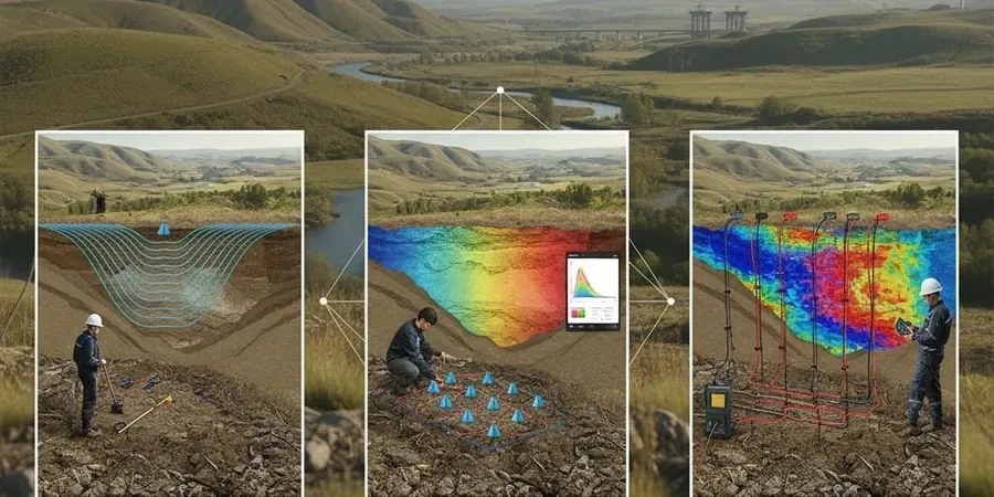
Seismic microzonation provides a spatially detailed hazard map that accounts for local geological variability, basin edge effects, and groundwater conditions across a precinct or municipality. Unlike a single borehole classification, microzonation uses geophysical arrays, numerous boreholes, and numerical ground response analyses to delineate zones of amplified shaking, liquefaction susceptibility, and landslide potential at a scale relevant to urban planning decisions.
Under the NCC and AS 1170.4, a liquefaction assessment is required where saturated potentially liquefiable soils exist and the design earthquake magnitude exceeds threshold values. In Newcastle, the Quaternary alluvium and estuarine deposits with shallow groundwater along the Hunter River floodplain and former swamplands trigger this requirement for most medium to large-scale developments, particularly those with deep foundations or critical post-earthquake functions.
The 1989 event demonstrated that moderate magnitude earthquakes can cause disproportionate damage due to site amplification on soft soils, unreinforced masonry collapse, and liquefaction-induced settlement. Current practice mandates ductile detailing, avoidance of soft-storey configurations, rigorous geotechnical characterisation of dynamic soil properties, and consideration of soil-structure interaction effects that were largely overlooked in pre-1989 designs.
We serve projects across Newcastle NSW and surrounding areas.